


Published on the 22/11/2016 | Written by Newsdesk
New Zealand’s skills in advanced spatial technology and geographic intelligence has underpinned much of the response to last week’s 7.8 earthquake…
That’s according to NZTech CE Graeme Muller; in a statement, he said, “When the earthquake hit the South Island last Monday morning, spatial experts across the tech sector and government were able to quickly assign four satellites over the area, remap and identify areas of critical needs and help coordinate and assign emergency responses across the top of the South Island.”
Using that technology, he said it was possible to map key areas across Wellington down to the detail allowing traffic redirection around at risk buildings.
The shakiness of the shaky isles and its ability to respond using advanced technology even provides something of a silver lining to the repeated incidences of serious seismic events: Muller said that not only has spatial technology played a major role in the rapid response to the latest major earthquake to hit the country, but that it is also a growing export opportunity for New Zealand.
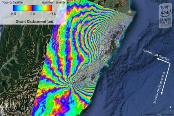
“Geospatial technology is playing a key role in supporting government agencies and the local authorities in the Canterbury and Wellington region respond to and manage the current earthquake crisis…[GIS provider] Eagle Technology moved quickly alongside the New Zealand Defence Force and Land Information New Zealand to task the global satellite company Digital Globe to acquire imagery over the affected transport routes.”
Undoubtedly a crucible of fire; Muller explained that this ‘multi-band satellite imagery’ is flowing into response agencies and has already helped identify the exact location and extent of damaged infrastructure, with imagery acquired in the days immediately following the November 14 earthquake providing a complete overview of the affected area.
He said organisations including Eagle Technology and Environment Canterbury have helped the Ministry of Civil Defence and Emergency Management and its associated regional offices to develop situational awareness maps, 3D scenes, site maps and building inspection applications to gather and distribute crucial information to stakeholders.
Further, “Using helicopters and specialised survey equipment, engineering services company Aurecon has assisted Canterbury Civil Defence with landslide identification and management. This information has revealed which bridges are passable. The next phase of work by Aurecon is to use drones to undertake aerial surveys and generate 3D models and volumetric calculations of the large land slips. These techniques have been developed and refined after the February 2011 Christchurch earthquake on the Port Hills,” said Muller.