


Published on the 15/03/2011 | Written by Newsdesk
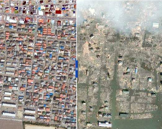
The NY Times has published a before and after pictorial of the coastal towns impacted by the recent earthquake…
In an incredible piece of interactive digital satellite imagery, the New York times in association with GeoEye, have produced before and after images of the devastating earthquake in Japan.
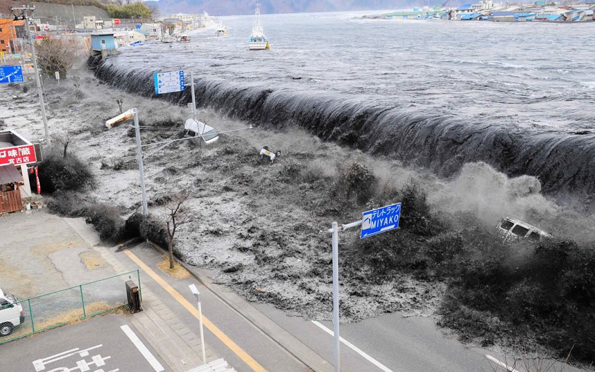
The 8.9-magnitude earthquake struck the Oshika Peninsula on March 11, 2011. According to news reports, this is the largest earthquake to hit Japan in recorded history and the fifth largest in the world. Analysts believe the powerful earthquake moved Japan’s main island eight feet (2.4 meters), shifted the Earth on its axis four inches (10 centimeters), and unleashed a devastating tsunami.
The imagery shows extensive destruction to buildings, vehicles and infrastructure. Entire regions have been flooded, swept away or reduced to ruin. The image was taken by GeoEye’s IKONOS satellite at 10:36 a.m. (local time) on March 12, 2011 from 423 miles in space as it moved from north to south over Japan at a speed of four miles per second.
Click on the image below to go to the NY Times website: