


Published on the 10/12/2008 | Written by Phil Parent
Advances in GPS technologies and location based services have made fleet tracking solutions more feature-rich and affordable. So what do you get for your money today and how are organisations taking advantage of the technology to gain a competitive edge?
Monitoring your mobile assets is now easier and more cost effective than ever before.
With the growing availability of low-cost GPS (global positioning system) and data acquisition transponders, accurate basemaps and wireless networks, you can now track the location of your vehicles, monitor their speed, engine temperature and oil pressure and even set off alarms if the vehicle enters a forbidden zone, all at a fraction of the cost of only a few years ago.
Importantly, all of these capabilities are relatively easy to install and implement and the benefits can be realised almost immediately.
The technologies behind the latest fleet management solutions are relatively mature. GPS and GIS (geographic information systems) have been around for decades.
But only in the last few years have the costs of combining the two into a viable, cost-effective fleet management solution reached reasonable levels.
GPS units are now smaller and more economical to operate and many companies offer accurate digital street maps. The pieces are all in place.
| GPS / GIS: The technology behind the solution |
|
The new breed of fleet management solutions are made possible by a space-age technology called GPS (Global Positioning System) combined with GIS (geographic information systems), or computer mapping. Operated by the US Government, GPS is based on an array of satellites – currently 31 – orbiting around the globe at an altitude of approximately 20,200 kilometres. These GPS satellites broadcast microwave signals on a regular basis that are picked up by the GPS receiver in the vehicle. As the receivers access signals from three satellites simultaneously, the GPS unit can calculate your exact location. The location information – a set of latitude / longitude coordinates – is then overlaid on top of a digital street map and displayed on the screen. The digital street map – which is supported by advanced GIS technology – is a key consideration. In order for the fleet management solution to work correctly, the digital street map must be accurate in respect to the exact location of the street centreline; it must be complete, especially with new subdivisions; and it must be accurate in respect to things like one-way streets, turn restrictions, barriers, etc. Some digital street maps include points of interest like speed camera locations, crash black spots and red light cameras. Many in-car navigation and fleet management systems, including TomTom, Argus Tracking, Navman and Locate+, use the SmartNAV digital database sourced from GeoSmart (www.geosmart.co.nz), a leading Kiwi-owned and operated spatial mapping organisation. GeoSmart have driven over 94,000 km of public roads in New Zealand collecting a large range of road attributes including correct road names, turn restrictions (one way streets as well as no left turn, no right turn etc), speed zones, paving, angles of corners (to assist in travel time calculation when the speed limit is faster than realistic driving speeds), type and angles of intersections, intersection controls and much more. Other providers of NZ digital map data include Critchlow Associates (www.critchlow.co.nz), used by Minorplanet, and LINZ (www.linz.govt.nz) used by Armada/Snitch. |
So what are the benefits of being able to track – in real time – the location, speed, and status of your vehicles?
If you are managing a pick-up and delivery fleet, you can immediately see which vehicle is closest to the pick-up location and assign that driver to that address.
If you operate a time-sensitive fleet, you can more accurately predict when your vehicles will be at their destination.
If you keep records detailing ‘windscreen hours’, mileage, petrol used or similar for chargeback to a client or to a job, you can quickly and easily import accurate data and create any number of management, payroll, invoices, road user charges or financial reports.
And if you spend a bit of time integrating your fleet management solution with financials, ERP (enterprise resource planning) and business intelligence (BI), you can spread the benefits throughout your organisation.
Fleet tracking solutions
In New Zealand, there are a wide variety of fleet tracking solutions on the market.
Most of the ‘plug-and-play’ options provide real-time, on-line monitoring of vehicles and reporting.
The more advanced packages can capture additional mobile asset information, support audio communications and can interface with third-party solutions such as financials, BI and ERP.
And then there are the customised solutions that can include advanced features such as route optimisation, spatial analysis, advanced mapping and customised reporting.
The underlying similarity between all of these options is that they all provide improved efficiencies, enhanced customer service and significant savings.
Most of the leading fleet management solutions offer similar capabilities.
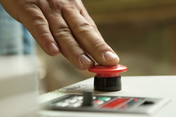
Technicians will come to your shop, install the GPS transceivers in your vehicles and show you how to log onto the password-protected internet map interface and run reports.
Those are the basics. Charges typically are based on the type of GPS unit (you can buy or lease the units) and a per vehicle monthly fee.
Anything else, such as integration between the system and your financials, two-way audio capabilities or customised reporting can cost extra. But for the basic services, the costs are surprisingly modest.
“If you’re not getting a fast ROI (return on investment) on your fleet management system, you’re not doing it right, especially if you dispatch your vehicles to different jobs in different areas,” says Aaron Muir, director of Argus Tracking.
“You can see at a glance which vehicles are closest to the job and send the most appropriate vehicle. You can tell clients when they can expect deliveries without having to call the driver. You can get much more productivity – and reduce petrol costs and save on wear and tear – out of each vehicle and driver,” says Muir.
“And while it’s hard to put a dollar value on enhanced customer satisfaction, you’ll get more return business and improved word-of-mouth with even a basic fleet management system,” he adds.
| Silverlake Electrical gains more control |
|
“Our Locate+ GPS fleet tracking solution from Telecom has already paid for itself in less than a year,” says Steve Curry, director of Silverlake Electrical, an Auckland-based commercial electrical service/supply company with a fleet of eight vans. “We’ve been able to minimise our down time, improve our reporting capabilities and reduce mileage and wear and tear on our vans by being able to dispatch the closest vehicle to non-scheduled jobs. We also save on communications because Locate+ supports text messaging. And just being able to see where each vehicle is at any given time gives us better control over our resources.” How do the staff like being ‘on the map’? “At first they were a bit apprehensive, the ‘big brother’ thing” admits Curry, “but after a while they saw that it actually made their jobs easier and that they could provide faster service. This has resulted in more satisfied customers which, in turn, improves staff morale. So now they love the system.” Curry says implementation was easy. “The Locate+ team came out, installed the Navman M-Nav 650 GPS units on the vans and showed us how to use the OnlineAVL map interface and run reports,” he says. “It took about a day. The enhanced reporting has been a tremendous benefit as we can now more accurately record mileage and times for particular jobs for charging. In the past, we had to rely on our staff’s job books and sometimes they were estimates at best. “Now we have exact information. And the pricing – a modest up-front cost and a monthly fee – has been a lot less than we would have thought. All-in-all, it’s been a good investment for us.” |
“One of our clients, an equipment hire service and delivery company, reduced their fuel bills by 40% within weeks of installing one of our fleet management systems,” says Andrew Sharp, general manager of Blackhawk.
“They operate four delivery vehicles in a dynamic environment. Now they can dispatch the best vehicle without having to call around to see who is closest. And if they’ve reduced their fuel bill, they saved an equally significant amount of staff time.”
Blackhawk entered the fleet management arena after developing GPS-based security systems for high-performance autos, heavy machinery and car finance companies.
“We worked with a lot of companies who had mixed fleets and they asked us to develop more capabilities for their vehicles that operated on the road,” says Sharp.
“So we looked at the market and designed a system that addressed most of their concerns. We developed the solution as a web service for easy integration and added functionality to reduce administration costs and support event-based tracking.”
Integration with complementary packages is a definite advantage.
“We’ve built our solution with embedded APIs (application programming interfaces) so that clients can tie in Armada to their ERP, CRM, BI and financials,” says Jeremy McLean, director of Snitch.
“This way customers can take the information generated by the system and use it in other applications. For instance, we are working to streamline reporting capabilities for road user charges.”
At the heart of any GPS solution is the digital street map. Many in-car navigation and fleet management systems, including TomTom, Argus Tracking, Navman and Locate+, use the SmartNAV digital database sourced from GeoSmart (www.geosmart.co.nz), a kiwi-owned and operated spatial mapping organisation.
Other providers of New Zealand digital map data include Critchlow Associates (www.critchlow.co.nz), used by Minorplanet, and LINZ (www.linz.govt.nz) used by Armada/Snitch.
How big?
How prevalent is fleet management in New Zealand? “We haven’t even scratched the surface yet,” says McLean.
“With the prices of fuel and staff eating up production budgets, people have to work much smarter. And keeping better track of mobile resources can go a great distance in reducing these costs. Sometimes we get questioned on the ‘big brother’ aspect of fleet management, but once we explain how it is all about efficiency and better customer services, people see the advantages,” he says.
“Knowing where your investments are and how they are performing when in the field is a ‘must-have’ for today’s fleet managers,” says Leo Verstegen, general manager – indirect channels at Minorplanet.
“We are entering a time when compliance is becoming more important. Being able to document where a vehicle has been and how long it was there is essential. And if you can plug that data into your business intelligence solution, you can start to see patterns of profitability and areas that need work,” Verstegen says.
“Businesses need real data in real time to maximise revenues and fleet management solutions go a long way in providing that information.”
|
Beyond fleet management Los Angeles police have been using tracking technology to “get their man” – firing sticky GPS tracker devices at fleeing criminals’ cars as of next year, according to reports. Technology website The Register reported the LAPD’s StarChase Pursuit Management System uses compressed-air laser-sighted launchers mounted at the front of a patrol car to fire “a miniature GPS receiver, battery and radio transmitter, embedded in an epoxy compound,” according to its makers. The radio data channel is cellular, which means that absconding villains can be tracked anywhere within network coverage. The Register said the idea of StarChase is that it could reduce the need for dangerous high-speed pursuits, letting cops fall back and track their quarry at leisure rather than burning rubber aggressively. Then, presumably, other units could move to trap the bandits later on, when the tactical situation was more favourable. StarChase went through beta testing with the LAPD in 2006. At that time LAPD Chief Willian Bratton said: “We believe this technology and the trials associated with it, will potentially give police officers yet another tool to minimize the damaging risks associated with high-speed pursuits. My goal is to protect not only my officers, but the general public as well.” Where’s my cows? Services include farm and drainage mapping, 3D farm image creation, aerial photograph digitisation, and measuring and marking GPS points with 2cm accuracy for applications such as installing centre pivot irrigation. WMC Farm mapping now provide a range of products and services including the “Do It Yourself GPS Farm Mapping Kit”, aerial photograph mapping kits, professional GPS mapping, irrigation design and layout, as well as building centre-pivot and lateral irrigation systems. Spidertracks At pre-determined intervals the technology sends a signal with three-dimensional GPS coordinates of the aircraft or vehicle to the Iridium network of 66 orbiting satellites, which is then beamed back to Iridium’s earth station and on to a secure server in New Zealand or Australia. The GPS coordinates are translated into a visual record of the vessel or craft’s flight path or journey and the information can be accessed via the internet. The satellite tracking system can be used by commercial operators to increase productivity and potentially save money by ensuring their craft are being utilised in the most cost effective manner. Zeroin It turns GPS-enabled mobile phones into tracking devices by simply sending their location via the mobile data network to the Zeroin site. Zeroin can provide users with location, speed and direction, all without specialist in-vehicle hardware. With Zeroin you can retrace any journey at any time – historical data and the ability to replay a journey on a map at any time means a business can quickly track staff activities such as customer visits made by sales teams, or track travel distances and ensure customer service levels are maintained. |