


Published on the 23/02/2023 | Written by Heather Wright
From the rainfall, to the power and cell tower outages…
Amidst the devastation of Cyclone Gabrielle, with its huge human toll, including at least 11 people dead, thousands displaced, and homes and in some cases livelihoods destroyed, has come increased scrutiny on New Zealand’s infrastructure.
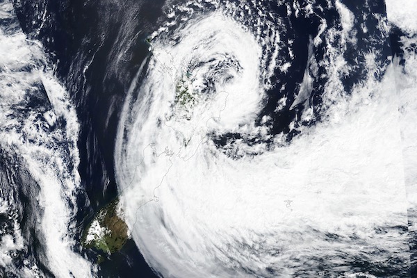
One of the most destructive storms to ever hit New Zealand, Cyclone Gabrielle saw power out to more than 250,000 people and entire regions cut off from telecommunications for an extended period – which continues today, more than a week on from the cyclone.
That’s prompted a call from Telecommunications Forum CEO Paul Brislen for a review into how telco’s deal with major events, who also questioned on the AM Show whether Kiwis should look at investing in Starlink – while acknowledging that the satellite service, used by Wairoa council, wasn’t an option for everyone and requires power.
Others have also pushed the satellite option for connections, and Gabrielle has spurred 2degrees to speed up its plans to offer Starlink business: The telco opened registrations for the service this week.
Meanwhile NZ IoT Alliance executive director Alison Mackie is calling for a thorough water data strategy for New Zealand, saying the absence of technology and data from the contentious Three Waters reforms is ‘concerning’.
“Technology such as a smart water network alongside a water data strategy can create efficient systems to reduce and cut energy, waste and costs to improve our steps towards water sustainability,” Mackie says.
While data might have been missing from the water reforms, it’s not missing when it comes to Cyclone Gabrielle’s impacts.
Here’s some of the key areas of Gabrielle’s impact, in charts (click on each for the latest status).
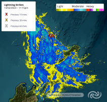
Metservice maps show the extent of the rain on Monday 13 February as the rain accompanying the cyclone was battering the North Island.
Satellite data overlayed onto LINZ maps by data scientist Dr Sadhvi Selvaraj and geospatial analyst and developer Ian Reese shows the extent of flooding across the Hawkes Bay (as published in The Herald):
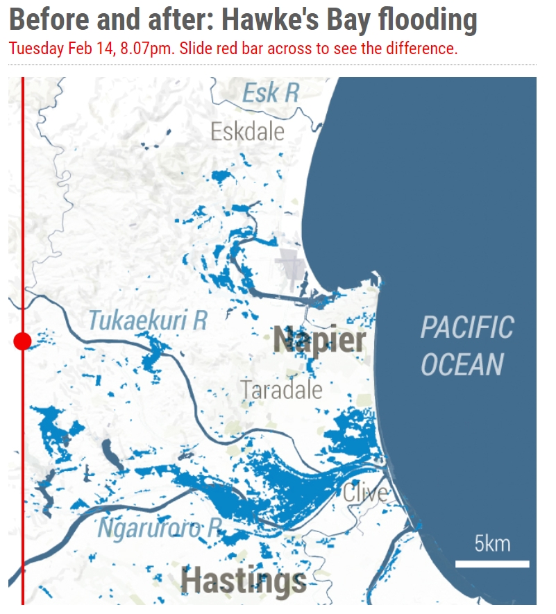
Head to Dragonfly Data Science for an interactive before and after, showing the extent of the flooding.
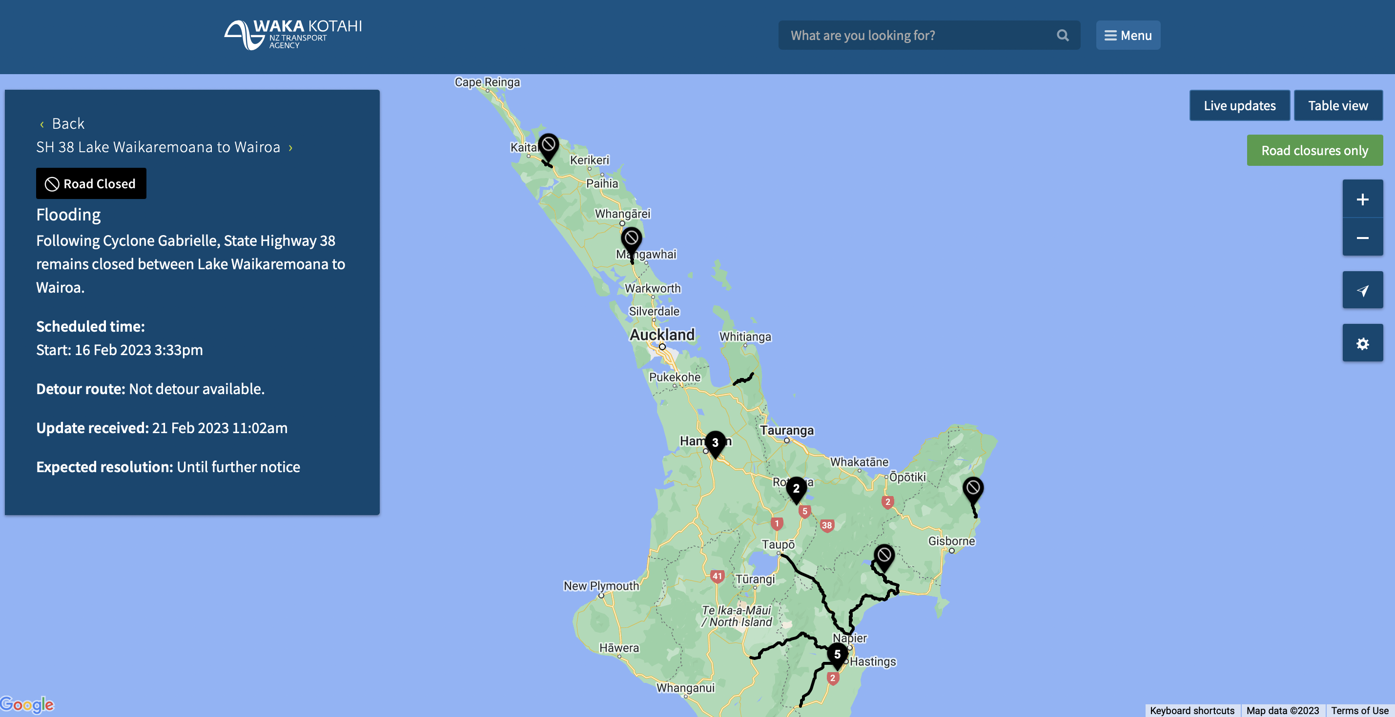
Waka Kotahi’s mapping shows the continuing impact of Gabrielle on roads on Thursday 23 February. Black denotes areas of road closures as roads were washed away or closed by slips.
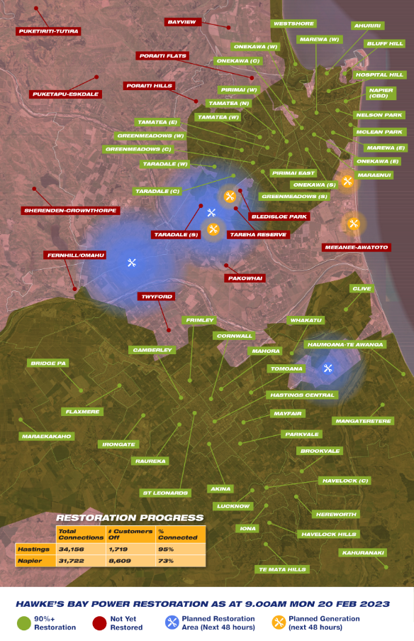
On the power front, more than 225,000 people were without power across the North Island on the Tuesday 14 February, as Gabrielle continued wreaking havoc. That number was down to 140,000 the following morning. Power companies are continuing to restore power.
Powerco says areas of the Coromandel and Wairarapa’s Tinui Valley require complete rebuilds which are the focus of work this week. Their outage map, from Monday, shows all outages, including cyclone related and scheduled outages.
Power company Unison’s outage map shows a similar story on Monday, with more than 10,000 customers still without power. That number was down to 3,500 on Wednesday afternoon.
Northland’s Top Energy was also still dealing with numerous outages this morning, though not all are cyclone related.
Eastland Network, which provides power to Gisborne, Wairoa and the East Coast, doesn’t provide an outage map. This morning it noted on Facebook that more than 100 more people had their power restored yesterday with 154 customers remaining without power in Tairawhiti and 17 in Wairoa. It also warned that the MetService’s severe thunderstorm watch and heavy rain warn watch could hamper plans to access some areas via helicopter. The company is still experiencing some ‘significant access issues and major damage’ and says it’s using generators in a number of places until infrastructure repairs can be finished.
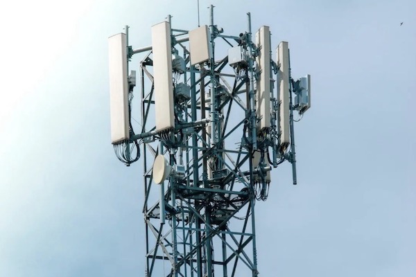
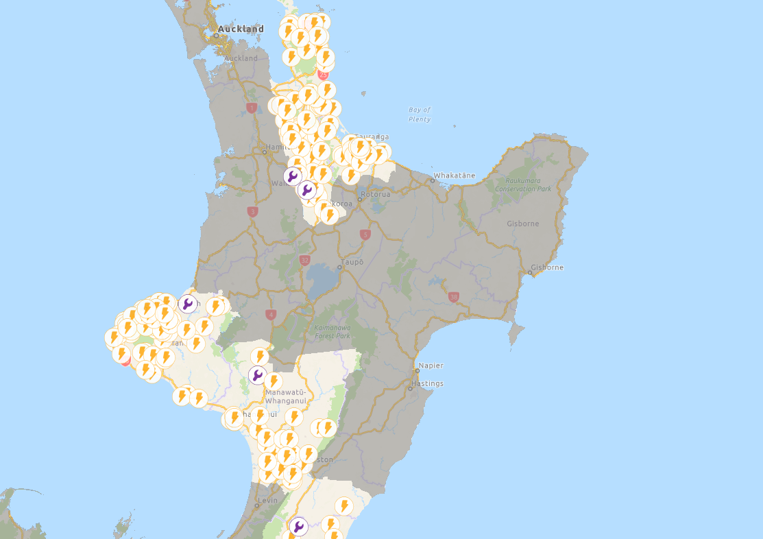
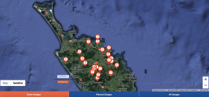
The country’s telcos activated an industry-wide emergency response on February 13, with widespread mobile and internet outages after cellphone towers were battered by the cyclone. Limited battery power at the some sites also proved problematic as time wore on.
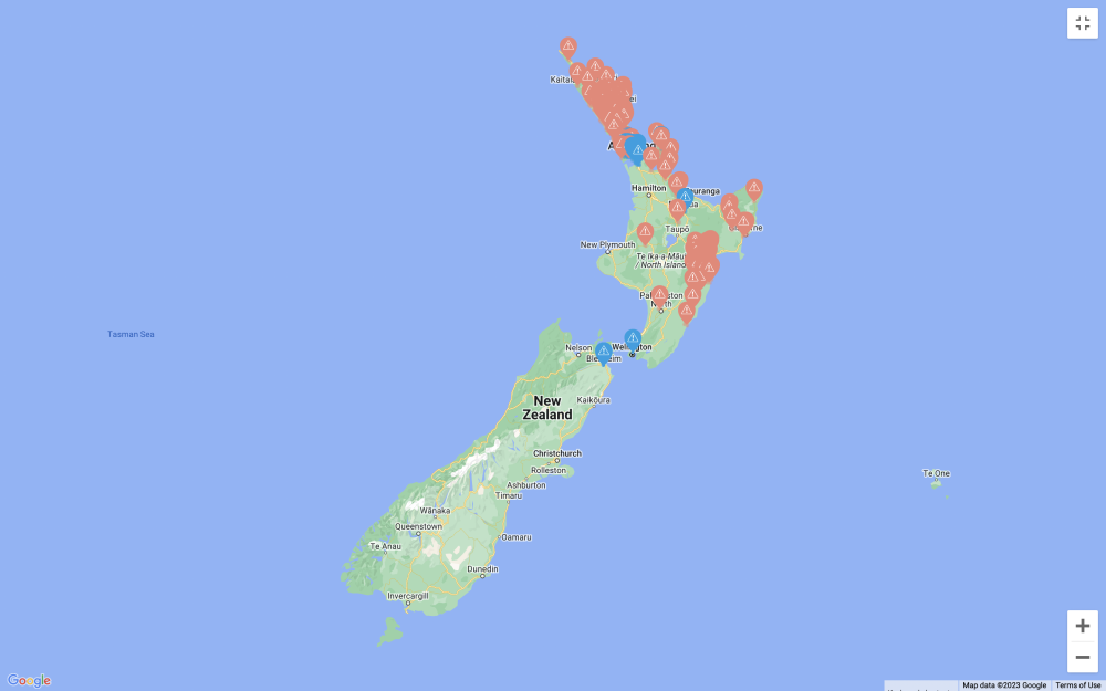
Spark continues to show cell phone tower outages across the East Coast, particularly around Napier and Hastings. The provider is working with electricity companies on power restoration and dispatching additional diesel generators to areas without power. Its efforts haven’t been helped by the theft of generators. Below was from Monday:
Vodafone CEO Jason Paris tweeted on Monday 13 February that 29 mobile sites across Northland and 12 in Auckland had power outages, with generators being deployed.
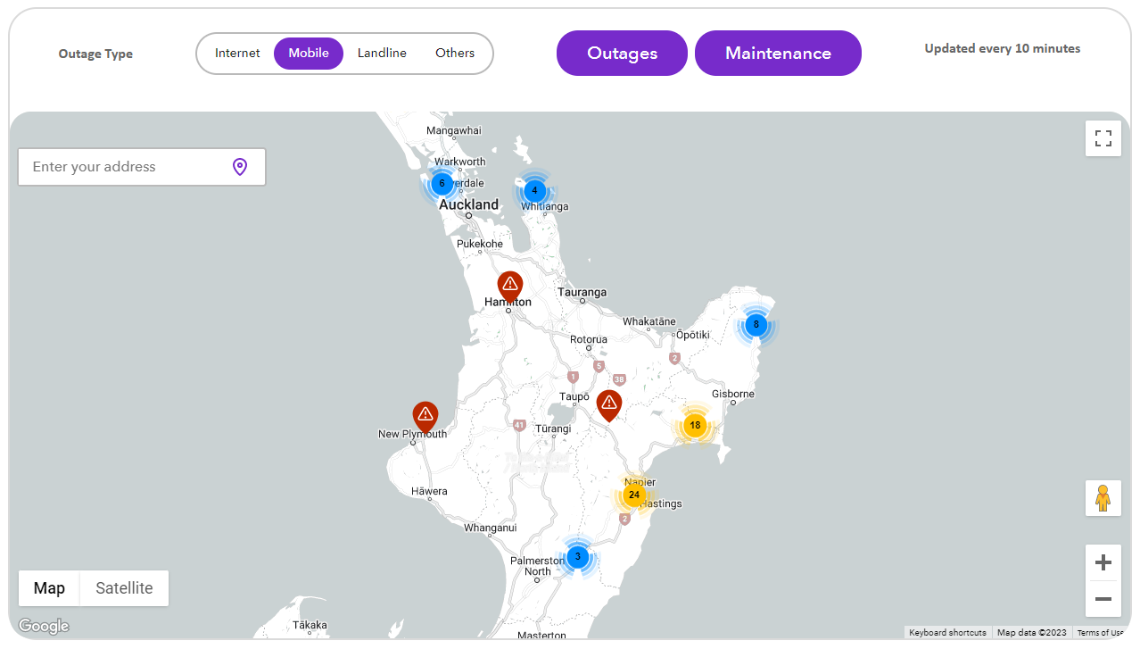
By this morning Paris says six sites were down including one in Napier, four in Northland and one in Auckland, with a further 1,000 fibre customers offline due to Chorus outages.
Below is Vodafone’s outage map for the East Coast from Monday.
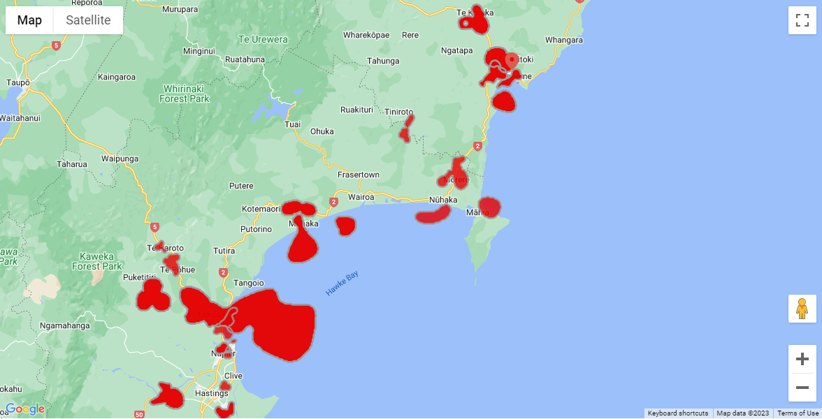
Chorus’ outage map from this morning, meanwhile, shows the extent of the repair work for the infrastructure provider which says the effects of Gabrielle continue to have a huge impact on the network. Outages continue in Northland, Auckland, Coromandel, East Coast and Hawke’s Bay.
“Some of these are major and widespread,” Chorus says. “In collaboration with Vodafone, Spark and 2degrees, and our field service partners UCG and Downer, we are working around the clock to restore connectivity.”